
As another rule of thumb I have learned over my years chasing is that YOU DO NOT IGNORE AN ILLINOIS WARM FRONT!!! No matter how strong a cap, how favorable the wind shear is in another state, or what the SPC is targeting. If there is clearing, plus a boundary/warm front, and you start mounting instability and your indicies are raising....then your ass needs to be parked under that Cu field. EHI's are looking much better near Kansas City, but the cap fails to erode whatsoever back there.
So what does this mean? All I am doing is spitting out indicies and numbers from what the models say.... I am saying this. With projected 1700+ SFC based CAPE, an eroding cap, meager low level lapse rates, and decent wind shear, we may be looking at the first tornado threat for N. IL for the 2011 season.
 |
| *LSI down to 0 and -1 over target area |
 |
| *Instability nosing into the TA |
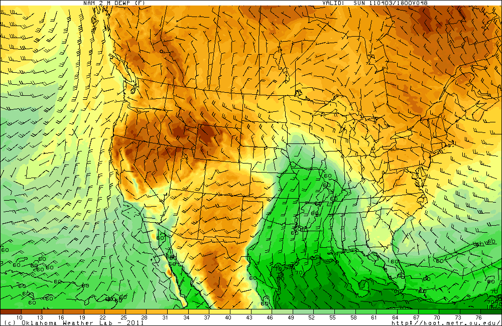 |
| *Moisture return feeding into the TA |
*60 degree dews nosing in
*Temperatures in the low to mid 70's
*Appreciable instability nearing 2,000 J K/G
*Slightly backed winds along and just to the S of the WF (depends if a secondary low develops in IA to wrap more moisture into the system and further back the winds
* An eroding cap (possibility)
* Low level jet ramping up
Cons:
* CAP
* No real forcing mechanism outside of the CF itself later at night
* Veered flow throughout the majority of the warm sector.
* Twilight chase perhaps
* Fast moving progressive system - by the time the next set up model runs come out, the threat could be in W IN for all we know.
To conclude, we would be looking at a major severe weather outbreak Sunday afternoon into the evening if the EML/700 temps/CAP/LSI/WHATEVER wouldn't be in Mid-June Iowa form. The most likely scenario is chasers will get a nice sun tan in a fast food joint of their choice. With a dryline likely to be intersected by the quickly moving cold front; thunderstorms should erupt after sunset in E IA down into E KS and move ESE along the front. Main threats would be damaging winds and hail. However, if the previous ingredients fall into place and a breach of the cap occurs, we could be looking at a couple isolated supercells from SE IA toward the KC area. A tornado threat would exist with these storms as a S low level jet enhances the low level shear. But the latter half of this forecast at this point in time is still <10% certainty.
Final prediction;
Virtual target: Donnelson, IA (I have work on Sunday so FAIL I can't actually chase it)
Ideal scenario: Supercell develops 21z in N. MO. Crosses the MS River near Ft. Madison and tracks along the WF into N IL. Producing photogenic tornadoes in the open farm land.
Official Forecast:. TCu galore with a struggling storm by sunset near Burlington, IA. With the projected LSI weakening, there is a small window for this storm to become supercellular and utilize meager low level instability and briefly become surface based and hopefully root on the WF. Otherwise the aforementioned erosion of the cap will allow for explosive thunderstorm development along the WF and CF stretching an MCS from NW IL to E KS. Severe winds and hail will be prevalent after 02z and reach me in Chicago perhaps toward 04z.
Total tornado reports: <7
Total Hail reports >30
Total Wind reports >60
Been a while since I have done one of these, I have to knock the rust off sometime. Let's hope my forecast won't bust!
No comments:
Post a Comment